Geometry-Instanced Glyphs as Navigational Interfaces for Scientific Data Exploration
Adam Zhengyuan Xu (ArtCenter College of Design), Leslie Liu (Carnegie Mellon University), Luke Fiorante (Harvard University), Brandon Woodard (Brown University), Casey Law (Caltech), Xianmei Lei (Jet Propulsion Laboratory), Darwin Chiu (Jet Propulsion Laboratory), Krys Blackwood (Jet Propulsion Lab), Maggie Hendrie (Art Center College of Design), Scott Davidoff (Space Science Institute), Santiago V Lombeyda (California Institute of Technology), Hillary Mushkin (California Institute of Technology (Caltech))

Jump to Discussion
Links
Sign in to access the Paper PDF.
Abstract
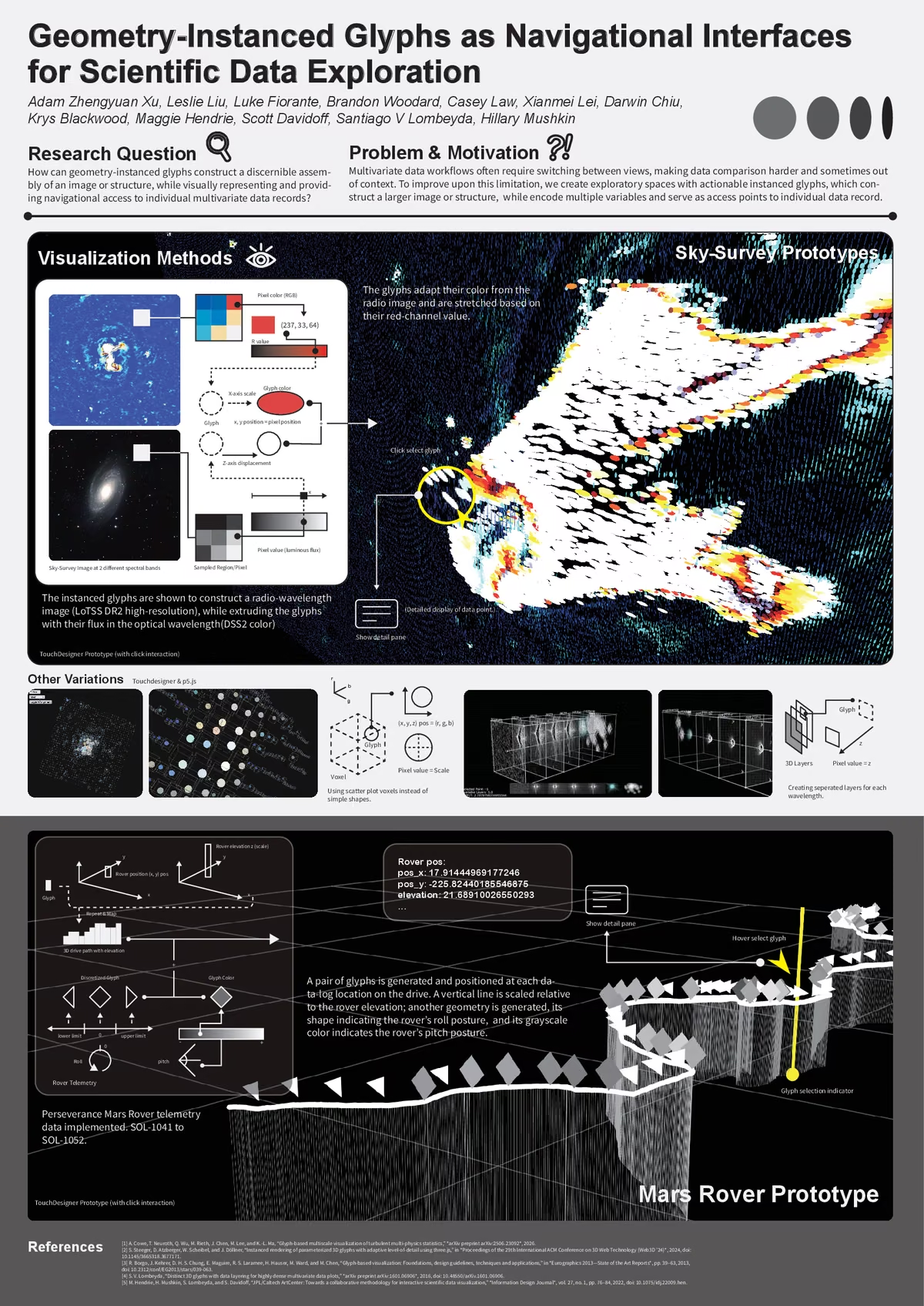
Scientific visualization workflows can require users to compare multiple data dimensions while locating points of interest within a larger image or spatial structure. This poster presents two manually crafted prototypes exploring a shared design concept in which individually encoded and interactive 3D glyphs collectively form a recognizable assembly that preserves this larger context. In one prototype, glyphs reconstruct multispectral sky-survey imagery while representing localized image data; in the other, they form a Mars Rover drive trajectory while representing associated telemetry. Geometry instancing in TouchDesigner is used as an implementation method rather than presented as a novel technique. Together, the prototypes explore a potential design approach for combining localized multivariate information with a recognizable overview within the same visualization.