StreetWeave: A Declarative Grammar for Street-Overlaid Visualization of Multivariate Data
Sanjana Srabanti -
G. Elisabeta Marai -
Fabio Miranda -
Download preprint PDF
Download Supplemental Material
Room: Hall M1
2025-11-06T13:12:00.000ZGMT-0600Change your timezone on the schedule page
2025-11-06T13:12:00.000Z
https://youtu.be/hoMn73KnXCg
Keywords
Urban visual analytics, design space, street-overlaid visualization, visualization grammar
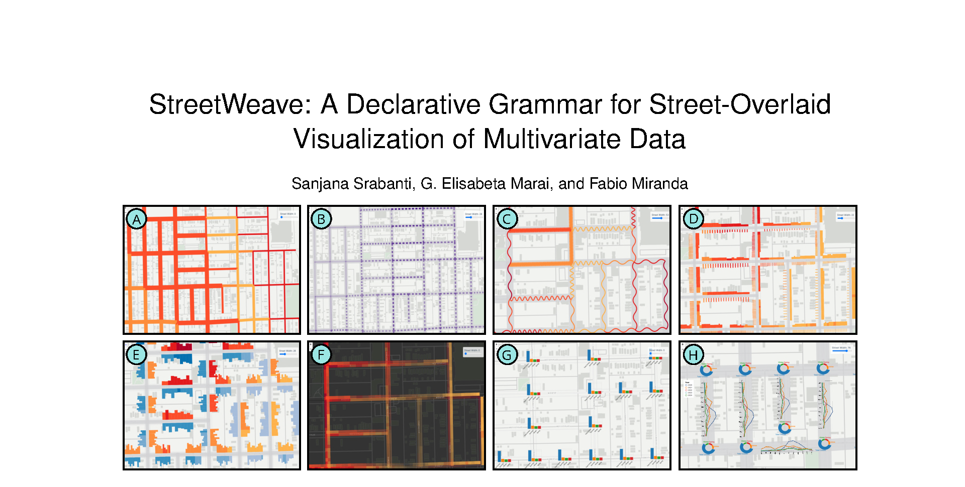
Abstract
The visualization and analysis of street and pedestrian networks are important to various domain experts, including urban planners, climate researchers, and health experts. This has led to the development of new techniques for street and pedestrian network visualization, expanding possibilities for effective data presentation and interpretation. Despite their increasing adoption, there is no established design framework to guide the creation of these visualizations while addressing the diverse requirements of various domains. When exploring a feature of interest, domain experts often need to transform, integrate, and visualize a combination of thematic data (e.g., demographic, socioeconomic, pollution) and physical data (e.g., zip codes, street networks), often spanning multiple spatial and temporal scales. This not only complicates the process of visual data exploration and system implementation for developers but also creates significant entry barriers for experts who lack a background in programming. With this in mind, in this paper, we reviewed 45 studies utilizing street-overlaid visualizations to understand how they are applied in practice. Through qualitative coding of these visualizations, we analyzed three key aspects of street and pedestrian network visualization usage: their analytical purposes, the visualization approaches employed, and the data sources used in their creation. Building on this design space, we introduce StreetWeave, a declarative grammar for designing custom visualizations of multivariate spatial network data across multiple resolutions. We demonstrate how StreetWeave can be used to create various street-overlaid visualizations, enabling effective exploration and analysis of spatial data. StreetWeave is available at https://urbantk.org/streetweave.